Sunday, July 6, 2014

Two Mouth Lakes

I am happy to say that I finally have a full backpacking-trip report for your enjoyment. The weather cooperated and allowed me to get out on this holiday weekend. No fireworks for me though; just the sparks from a campfire in a place I consider to be paradise. This weekend's excursion took me to Two Mouth Lakes in Idaho's Selkirk Mountains, one of my top five favorite campsites from last summer!

My elevation profile
Water on trail
The trail to Two Mouth Lakes climbs about 1800 feet over the course of 4 miles. For the first 3/4 mile, the trail follows an old road that is hot/dry and overgrown with alder. It climbs steadily through forests of western hemlock, subalpine fir, and Englemann spruce. There is even a section with some of the largest western white pines I have ever seen, with one roughly 4 1/2 to 5 feet in diameter. Being that there is still a substantial amount of snow in the highest reaches and temperatures are hot, there was seasonal runoff everywhere. After about the first mile, water covered much of the trail whether it was flowing like a stream or just overly swampy/muddy. Even through the sections with wooden walkways, water flowed up and over with no place to go. Fortunately, I wore a pair of Gore-Tex shoes and my feet stayed dry as I sloshed right through.

Snow before the pass
Southwest from the pass
As the trail neared the pass at the 3 1/3 mile mark, I hit heavy snow. The higher elevation area still contained patches 2 to 4 feet deep. However the trees began to thin out making navigation much easier, just slow-going as I kicked in steps uphill. Once on top of the pass, views of the surrounding area really opened up, including a fantastic view of Harrison Peak. From there, the trail descended gently towards the two lakes. 

Looking across lower lake outlet
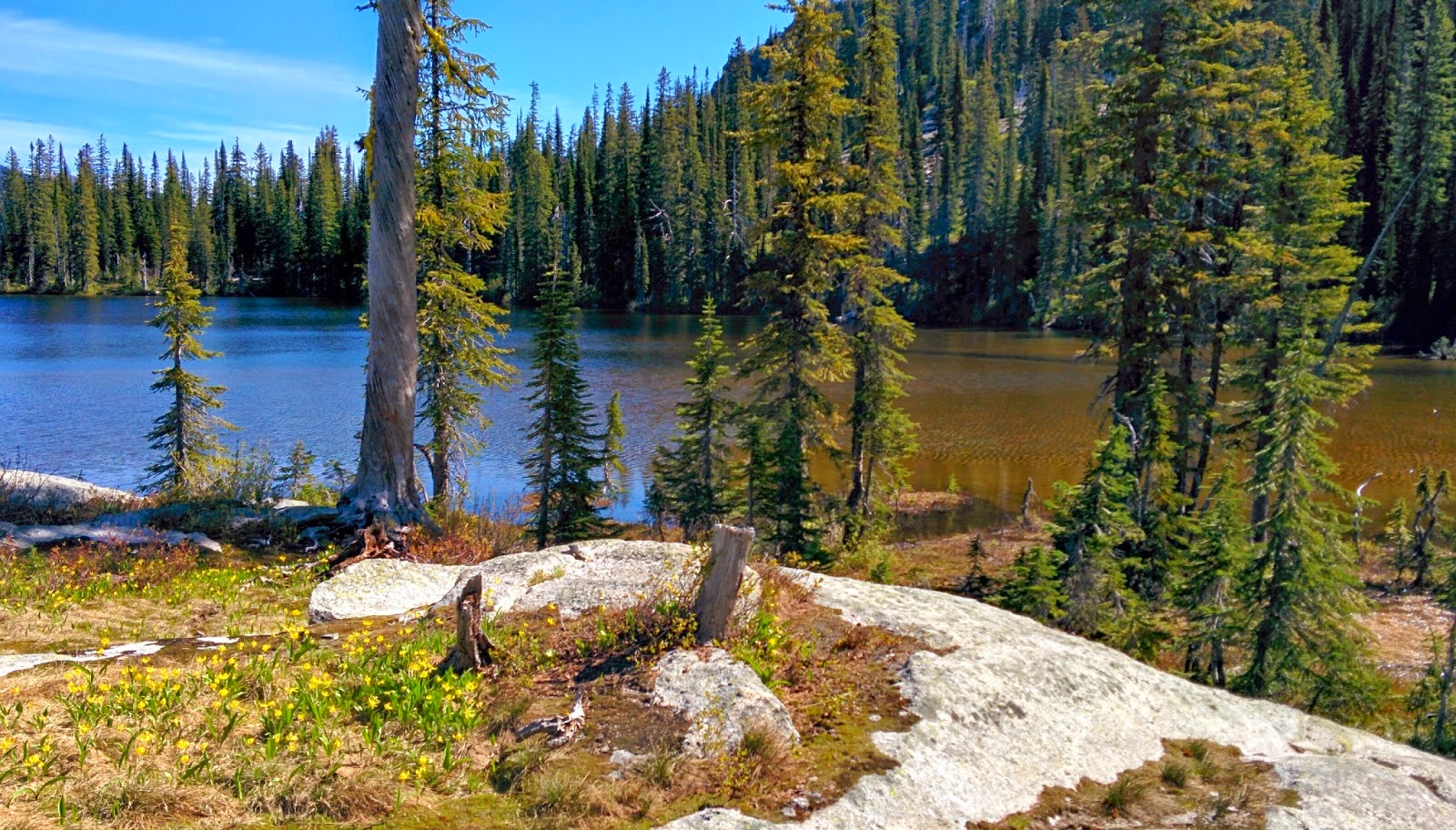
Two Mouth Lakes sit in a large, marshy basin at around 5800 feet. The two very pretty lakes are surrounded by subalpine fir, Englemann spruce, and even some whitebark pines. The trees here tend to be stunted and twisted from the high elevation/wet conditions and are well spaced making the basin feel more open and viewable. Giant boulders are intermingled with grassy areas, dotted by marshy pools and flowing-water lined with huckleberries, round-leaf violets, and glacier lilies. If I were a moose, this would my home. This area is designated official grizzly bear habitat but unfortunately I did not see one or any wildlife for that matter. Small patches of snow were scattered throughout the basin, but not so much as to prevent me from finding a dry spot to pitch my tent.

Waterway connecting upper and lower lakes
Lower lake outlet
West across lower lake
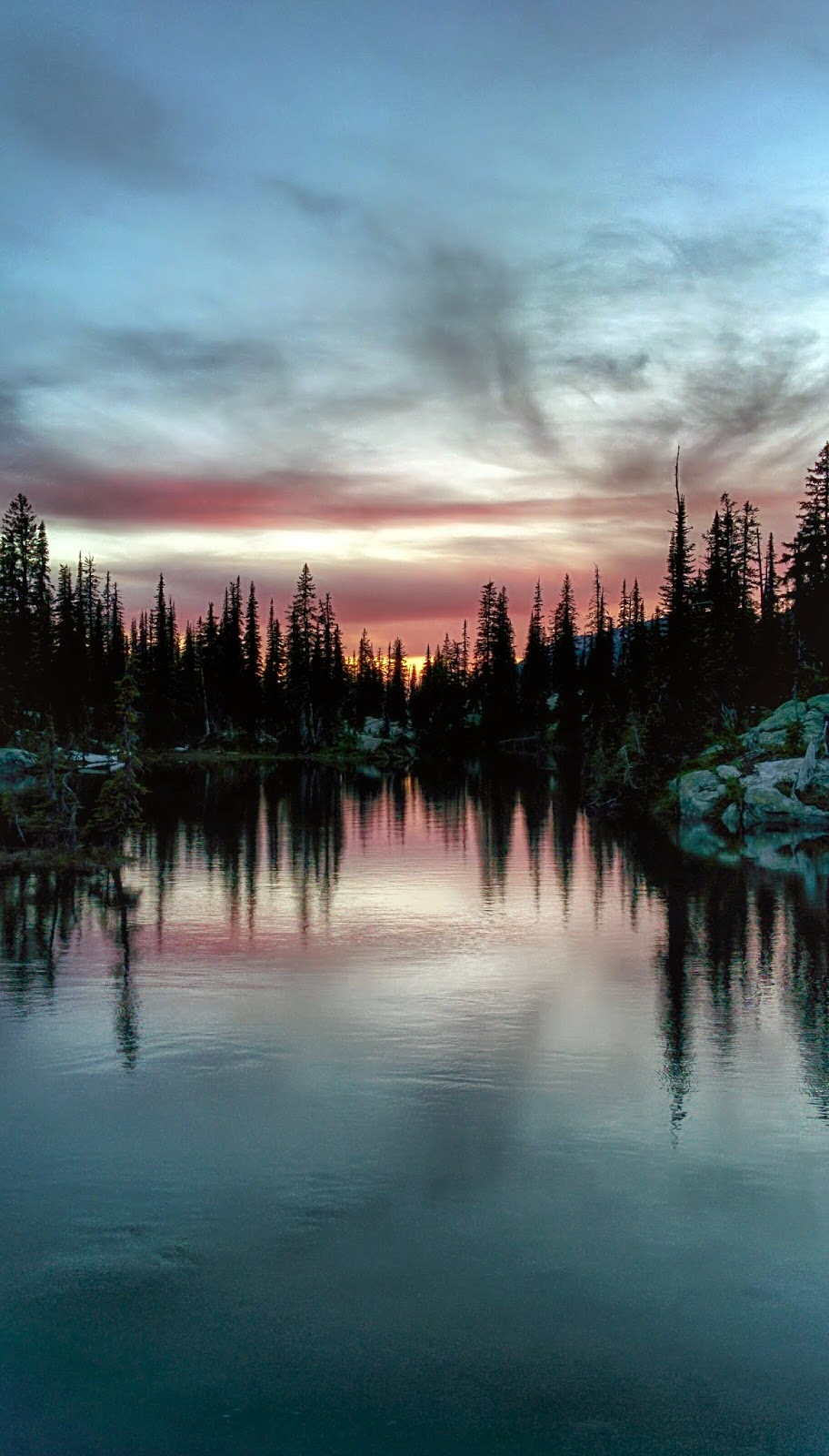
Sunset on lower lake
Upper lake
There was no one at either of the lakes when I arrived and that night I enjoyed the the lower one all to myself. Friday morning I awoke to the sun peeking over the trees, announcing that the weather for the day would be clear. I had packed enough food for two nights and decided to leave my camp and explore the surrounding area. First, I made the short 1/2 mile trek to the upper lake which  is larger than the lower, but not as scenic in my opinion. It lacks the quaint-grassy feel of the smaller more marshy lower lake where I prefer to camp. At the base of the peaks to the south of Two Mouth Lakes, there sit two more lakes known on my map simply as lake 6291' and lake 6321'. Neither one of these name-less lakes has a trail to it and I decided it be worth the trouble to bushwhack up to these rarely-seen gems. The trek to these lakes includes a climb of about 600 feet over 1 1/2 miles. The majority of the climb was on the north aspect of a hill and therefore was almost entirely over snow. The snow actually made the hiking easier as it kept me elevated above the brush and provide good solid footholds. I wore my crampons and used my trekking poles which made the trip much easier. The lower lake sits in a granite cirque below a name-less peak and the snow-surrounded water was still mostly frozen. The larger upper lake, which sits in the cirque at the base of Harrison Peak was almost completely thawed out. Harrison Peak is a very recognizable feature in the southern Selkirks and I hope to summit it eventually from the other side. Even with the snow, the trip to see these remote lakes was well worth it.

Lake 6291'
Lake 6291'
Harrison Peak above lake 6321'

Sunset lower lake
My campfire
That evening, a number of other hikers arrived at the lower Two Mouth Lake. Although it was no longer my own "private" lake, they were courteous and quiet and I still had a very enjoyable 4th of July as I watched the sunset. It may sound dumb and cliche, but to me personally, wilderness is what America is all about. These places offer freedom from the problems of the modern world and a chance to live more simply, if only temporarily. I hope that future generations will understand that the land is one of the factors that makes this country great and we must leave some of it wild.

"In every walk with nature, one recieves far more than he seeks." -John Muir

Waterway connecting upper and lower lakes
White mountain heather along shore of lower lake
Red, white, and blue sunset on lower lake
Waterway connecting upper and lower lakes
My campsite

Monday, June 30, 2014

This is Trail Maintenance: part 1

Due to the rainy/cold weather this weekend, I decided it was a good time to take care of some things I needed to do back in Spokane. Therefore, I do not have a trip report this week. Instead I'll begin a series of posts detailing the work that we do as a trail crew.

A trail crew is responsible for maintaining the network of trails within their district. With hundreds of miles of trail in ours, it seems like a never-ending task. However I enjoy it because even though it is very hard work, it's rewarding to work in such beautiful outdoor environments. As a hiker, it feels good to know the amount of effort that goes in to ensuring I have a pleasant hike. I enjoy the hike because I enjoy being out in nature and ironically nature is the opponent of the trail crew. It is a fight that neither side will ever win, even though nature always has the lead. All we can do is hold steady, never stopping.

The large majority of our work includes brushing and logging out trails. To ensure trails are free of obstructions, brush along both sides is "mowed" with a chainsaw and trees that have fallen over the trail or pose a hazard of falling over the trail are cut out. Sawing is usually done in two-person teams with a sawyer who cuts with the saw and a swamper who is responsible for clearing the cut material so it is out of site of trail users.

Another major component of our job is tread-work. This involves working the actual dirt of the trail to widen, level, and smooth it out so users will have an enjoyable trek. Rocks and roots provide extra obstacles to climb or trip over, water flows down trail causing ruts and erosion, and plants grow in from the sides making tread narrow. We manage all of this with hand tools and hard work.

In preparation for an upcoming project to build wooden walkways along swampy trail, a helicopter delivered materials to our various backcountry work-sites. This can be seen in the video and I look forward to the actual project which will begin at work-camp next week. So enjoy the video, I will have more of these later showing some of the various tasks and places we work.


Sunday, June 22, 2014

Burton Peak and the Moyie River

I was incredibly excited to hit the trail this weekend and kick-off my backpacking season. The weather this week was wet and cold to say the least and provided for some less-than comfortable working conditions in the mountains. So I intensely watched the forecast for the weekend and was pleased to see warm temperatures and sunshine. Friday morning, I packed my gear and by early afternoon I was off towards Burton Peak in the Selkirk mountains.

Burton Peak

Burton Peak from
the Ranger Station
Burton Peak sits on the eastern edge of the Selkirk mountains, directly west of the Bonners Ferry Ranger Station. Although snow packs are still high in the deeper reaches of the Selkirks, I could see that only a small patch of it still clung to the rocky peak. 

Tall stand
The 2.6 mile hike to the summit begins in a large parking turnout at the end of a long, rough forest service road. As I threw on my pack and left my car, it was warm and the sun was making extended appearances between intermittent cloud cover. The trail gains about 1700 feet as it follows the ridgeline through heavily forested areas of western hemlock,western red cedar, and grand fir which is occasionally interrupted by open stands of  huckleberry bushes towered over by lodgepole pine and western larch. Every now and then, a rocky yet heavily wild-flowered meadow sneaks itself into a clearing along the trail and provides a welcome burst of sunlight with treeless views of the Selkirks to the west and the Kootenai Valley, Cabinet mountains, and Purcell mountains to the east. The Forest Service still haven't done much work in the Selkirks due to the snow and because of this the hike was slow due to the 25+ fallen trees across the exposed ridge.

Open stand
Ridgetop meadow

Forested meadow
West towards the Selkirks
As I got closer to the top of the peak, the views to the west in the Selkirks really opened up and although the exaggerated granite peaks looked beautiful with their patches of melting snow, the sky above contained trouble. Dark clouds began to swallow the tallest peaks and brought with them what appeared to be a solid wall of rain that was slowly whitening-out layer after layer of mountain as it crawled east directly towards me. As I looked ahead, I could see the summit of Burton only 0.7 miles further. There were flashes followed by booming-thunder in the clouds directly over myself and the peak.Unfortunately, I could also now see that the small cabin which once served as a lookout sits on top of a very exposed granite knob. Since I was still close to Bonners Ferry, I was able to get a wireless signal and decided to check the current forecast. Sure enough, the ever-changing mountain weather called for thunderstorms from the west until midnight. So I decided to turn back, a decision I hated to make but I know my limits. There would be no camping on Burton Peak that night.

The cabin on Burton Peak
Burton Ridge
Within 5 minutes of turning back, the winds were absolutely howling and soon they brought heavy rain to the ridge. I began to really hustle (run) downhill while being pelted with high-velocity sideways-rain. There was a 10 minute period of mostly cloudy sky, followed by another wave of rain much like the first, that lasted until I reached my car. After 15 minutes of sitting in my car and warming up, the skies cleared once again, however ominous clouds still continued to linger in the west. There was a small fire ring and space for a tent near the parking turnout and although I really wanted to camp out, I was deterred by the strong winds and possibility of more storms on the high-elevation saddle. So I decided to drive down and find somewhere to camp in the valley.

East towards Bonners Ferry
West towards the Selkirks

Meadow Creek at the Moyie River

My campsite
It was 7:00 pm by the time I got back into the valley and had to decide where to next. Knowing that the Forest Service operates a handful of campgrounds within our district and I was running out of daylight, I did some quick research online and determined that the Meadow Creek Campground on the Moyie River would be best. Located in the Purcell Mountains, reviews claim it offered somewhat more secluded sites than other campgrounds. When I arrived about 7:30 pm, I was quickly greeted by the friendly host and given tips on the best available site. Taking her advice, I found a nice tent pad tucked back into the trees, away from the RV's.

Moyie River
It was a little cold that night and rained briefly however I managed to stay dry and mostly-warm. A short trail leads along the Moyie River on the edge of the campground and provided great viewpoints. By late-morning I was packed up and heading back to the Ranger Station.

Moyie River
It is somewhat discouraging to not have completed the hike I had set out to do. I was excited to stay up there for a night or two, exploring the ridge and enjoying the scenery, but the Selkirks receive more precipitation than anywhere else in Idaho and the turbulent spring really hangs on up there. The Forest Service will get to the Burton Ridge trail in the next week or two and hopefully I will be the one to saw it out and finish the hike. I know however that there will be many more opportunities as summer hits these mountains and I look forward to them.


Sunday, June 15, 2014

Back to Blogging!

It's time to dust off the old blog and shine 'er up. That's right, LeisurelyLost is being resurrected! Although I've regularly updated my flickr account with current photos, I've had some requests to get back to blogging.

In the last few years since I completed the PCT, I've been busy with school and summers working away from home. As mentioned in an earlier post, I spent the summer of 2012 working and playing in Yellowstone National Park. It was a wonderful experience in a truly unique place and it left me with a soft spot in my heart for the area. Maybe my career will one day allow me to return to the region. Summer of 2013 involved completing a volunteer-internship for my forestry degree with the US Forest Service Trail Crew in Bonners Ferry, Idaho. As a hiker, it was genuinely rewarding to give back to the trails that I love to use so much. The surrounding mountains in the Bonners Ferry district provided ample opportunity for me to get out and backpack on the weekends. I visited some incredibly beautiful and remote places and had some great adventures.

Trail work consists of mostly hard-manual labor, but I must have forgotten that because I have returned to the Bonners Ferry Ranger District for the summer of 2014. Fortunately, this time I've secured a spot as a paid-employee of the US Forest Service. I once again look forward to maintaining and upgrading the trails in this beautiful district and relaxing at remote sub alpine lakes on my days off. These weekend excursions are what I would like to share with you and I hope that you can get an idea of how magnificent these wild places are through my words and pictures. Enjoy!


The Selkirk Mountains from the Bonners Ferry Ranger Station

Snow Creek Falls

Two factors prevented me breaking out the tent and escaping to the mountains this last weekend: the snow and my body. Although the Selkirk mountains top out at under 8,000 feet here, the snow still hangs on to the craggy-granite peaks, especially in the northern shadows. This makes many of the Forest Service roads still impassable in their upper-reaches and hiking unpleasant through miles of snow banks. Don't fret though; it is hot here and melting fast. Secondly, my body said no. Same as last year, the first week of trail work has managed to make my body feel tired and broken as it is whipped back into shape. This makes backpacking seem like more of a chore, although if it weren't for the snow I'd probably go trekking anyway.

So this weekend included only a couple of short hikes and resting in Bonners. The first hike was a short 1.1 mile hike to upper and lower Snow Creek Falls. This low-elevation trail is easily accessed from town and is a nice gentle-grade, suitable for casual day-hikers or even just a walk with the dog. Due to the heavy snowpack and the recent high temperatures, the falls were especially high.

Upper Snow Creek Falls

Upper falls is larger and more extreme than the lower falls, although both are equally impressive. However, the sheer volume of water coming down the upper falls ensures that you will be blasted with wind and mist. In the shaded cedar/Doug fir forest this provides a cool windy retreat from the summer heat. Wooden walkways and railings provide an up close view of both falls, while maintaining a safe distance.

Lower Snow Creek Falls

Deep Creek

My second hike of the weekend was a 4.4 mile hike along the dike that follows Deep Creek in the Kootenai National Wildlife Refuge. This refuge sits in the Kootenai Valley that separates the Selkirk mountains from the Cabinets and Purcells. The trail is completely flat for the entire journey, making it a nice hike for anyone who would like to see many species of birds flocking to the reserve's ponds and maybe even larger animals such as deer and moose.

Kootenai National Wildlife Refuge

Copper Falls

Finally, I visited Copper Falls with a few of my roomates. Only 1 mile south of the Canadian border in the Purcell mountains, this 0.8 mile hike takes you to an overlook where Copper Creek cascades for 80 feet over a rock escarpment. 

Copper Falls

Here is a short video I made with footage and pictures from the hikes. I hope to include one with each post.


This Weekend...

So all of this happened last weekend and unfortunately the thunderstorms and cool temperatures prevented me from leaving with my pack this weekend. I'm anxious to get out and hope next weekend includes better weather.


Sunday, September 16, 2012

New photos to Flickr

 
Wow, it's been awhile since I've been on here to make an update. One week from this Tuesday will be exactly one year since I completed my thru-hike of the Pacific Crest Trail. Some of you may know that I spent this summer living in West Yellowstone, MT and exploring the surrounding area. So once again, I just wanted to share my FLICKR account link so you all can check out my newly posted photos!
-Headbanger

Wednesday, September 28, 2011

I did it!

That's right, September 25 at about 10:30am, I reached Canada! 5 months, 2,656 miles, and 6 million steps from when I left Campo on April 23. What an amazing feeling that was to stand at the northern border of the US, after walking across the country all the way from the southern border. Even the rain that pounded down on me that entire day, could not dampen the excitement and success that I felt. Over 5 months, I've experienced pain, sweat, tears, blood, fear, loneliness, cold, hot, thirst, hunger, and exhaustion. However, the good will always out-weigh the bad and I have no regrets about the trip; I'd do it again in a heartbeat!

So I left the Dinsmores near Skykomish, with Jimbrick, Wiz, and Buttercup. Unfortunately, I lost Cricket when he left, due to the fact that I wanted to let my shin splints heal up a bit. Cricket did achieve his goal of hitting the border on September 24, so he could make it to school on the 27. Congrats man, wish I could have been there with ya! Anyways, I hiked with those three from Stevens Pass all the way to Stehekin. We had a great time together as we wandered through some of the most rugged terrain on the entire trip, Glacier Peak Wilderness. It was beautiful and fortunately it only rained on us about half the time ha! That's good luck, for Washington anyways! My shins also felt great the entire way and never gave me any more problems. Despite the wet weather, this made the rest of the trip much more enjoyable.

When the four of us got to Stehekin, I decided to get my resupply box and get right back on trail. I was aching to get this last stretch done as quickly as possible and go home to see my friends and family. Jimbrick, Wiz, and Buttercup wanted to stay in town for a bit, so I hit the trail alone once again. The weather continued to worsen over the next few days, as I began pushing big 30+ mile days to get to the border. The north Cascades up above Rainy Pass blew me away with stunning beauty and sheer ruggedness. I set myself up to hit the northern terminus on the morning of the 23rd and passed Balls and Sunshine that morning as they returned from the border to Harts Pass. I got to the border, spent some time celebrating (alone unfortunately), and began the 30 mile trek back to Harts Pass myself. I camped that night with about 14 miles left to do in the morning, to Harts Pass where I would hitch down to Mazama or Winthrop to call my dad for a ride. I never saw it coming as I went to bed that last night, too excited to think about what might go wrong...

That night it got very cold, one of the coldest nights I'd had on the entire trail. It rained all night, up until morning when I awoke very excited that I did not hear the pitter-patter of the water hitting my tent. But when I opened my tent, I found the rain hadn't stopped, it had just turned to snow! I gathered my stuff up very quickly and began the journey back to Harts Pass. As I climbed higher towards the pass, the snow came down harder, and began to accumulate more and more on the ground. When I finally arrived at Harts Pass later that morning, there was already 3 inches of snow on the ground and it continued to pound down hard. 2 days prior, I had passed through the area and seen 50+ cars there with people camping, hunting, and hiking. That morning however, there was no one.

I freaked out. I'd expected it to be an easy hitch from Harts Pass down to the highway. I certainly didn't expect it to be snow covered and deserted! Everything I had was soaked from the days of rain and now I was cold and shaking and very alone in a near whiteout. I did not have enough food to hike down to the highway and I was not prepared for conditions this cold and brutal. I found the outhouse and cowered inside to escape the elements. I broke down in the bathroom as I shivered and contemplated what I would do. I really had no idea, I just wanted to go home so bad! 2 1/2 hours passed as I sat helpless in the outhouse, when I heard the sound of an engine. I ran out of the bathroom, waving my arms in the air as a truck crawled up through the snow on its way down the mountain. 4 older gentlemen sat inside and I asked if I could possibly get a ride to the highway, the town, anywhere where I could make a phone call. They generously made room for me and I was saved! These 4 men had been up looking at old rusty mining equipment when they'd realized this was the not the day to be up there and decided to turn around. I truly think this was a god-send and someone was definitely watching over me, as we passed no one else on the way down the long, winding forest road. Carl, the driver, invited me back to his house in Winthrop where his wife Roxy fed us, laundered my clothes, and provided a hot shower as I waited for my dad to pick me up. Even though this was their first time bringing a hiker home, Carl and Roxy are true angels that were there for me during one of the toughest times on my entire trip. I am so grateful to them!

So here I sit at home, in a chair, with a roof, freshly showered, full of good food, and a television making noise in the background. As much as I love all these luxuries, I must admit that I miss it already. The trail was my home for 5 months and the thru-hikers were my family. I had the most amazing time on this trip, I can't even begin to find the words to explain my experiences. Keep following, as I have a wealth of photos still to get posted on here and in the next week or two I will be working on a sort of post-trip closing post. I have a lot of things I'd like to say about my adventures, the places I've been, the conditions I traveled in, the people I met, the help I received, and hopefully some great advice to the thru-hikers of the future. Thanks for following everyone, I love you all! -HeadBanger

Saturday, September 17, 2011

Walking in the rain...

Hey guys, I'm currently at the Dinsmore's Hiker Haven in Baring, WA. And man am I glad to be here, because is pouring rain outside. Only had about 10 miles to do this morning to make it down to Steven's Pass. When we reached the trail head, Cricket and I had just planned on hitching up HWY 2 to Skykomish or Baring, but trail angel Tom was already there waiting to give any needy hikers a ride. Thanks Tom!

We have been so incredibly lucky with our weather here in Washington. It has generally been in the 60 to 70 degree range everyday with sunny skies and decently warm nights. However, that all changed after leaving Snoqualmie Pass on Wednesday. The first night out, it began raining and never really stopped. Not only has it been raining, but the temperatures also dropped considerably. This all makes hiking fairly miserable and I look forward to the nights when I can climb in my warm comfy sleeping bag and forget about the cold rain that pounds my tent. I guess it was bound to happen sooner or later, after all, this is Washington right?

As if the rain and cold wasn't bad enough, I'm now dealing with a new injury. Just in the last two weeks, I've began to experience shin splints. They typically like to begin bothering me sometime in late afternoon and make the pounding footsteps very painful. I've had them on both legs now, although it typically only hurts on one leg at a time. It started in my right leg before White Pass, however after a night of rest I no longer noticed it. Now it's mostly been my left shin, causing me pain about every other day this week. The pain usually goes away after I've slept for the night and given my legs some time off, but today it still hurt when I woke up. This is an injury I've never felt before and I wonder why it decided to start acting up now! You'd think by this point my body would be tough as steel after 2400 miles of training. Well at least I'm here at the Dinsmore's, time for a day of rest and I'll assess the pain in the morning...

Cricket and I spent the week walking through the Alpine Lakes Wilderness, which I hear is extremely beautiful. Unfortunately, we didn't get to see a lot of scenery. Just clouds and rain for us and the occasional view of a turquoise colored lake. The terrain is becoming more and more rugged as we get deeper into the North Cascades. Next up we'll enter the Henry M Jackson Wilderness and then the much loved Glacier Peak Wilderness. I am so happy to be getting closer to the completion of my goal and the end of a very long trip. This is no time for new injuries, as I am less than 200 miles from the border. This last week has left me with very low morale and I hope I can turn that around in the next few days. So here's hoping the weather gets better and the injuries subside. We'll see you soon guys! -Headbanger