|
Elevation Profile
to Little Harrison Lake |
This week's hike was one I've been thinking about since last summer. Just South of our district, Little Harrison Lake sits nestled in a secluded basin in Sandpoint's district of the Idaho Selkirk Mountains. Although no trail to the lake exists, it can be reached via a moderate scramble over the ridge from Beehive Lake. Because this lake is harder to reach than many others, it offers more seclusion than it's very popular older-sibling, Harrison Lake.
 |
| Mountain Ash |
Once again, Justin joined me for this trip and we set out Saturday morning. According to the forecast, weather for the weekend was mostly cloudy with no apparent threat. When we reached the Beehive Lake trailhead on the Pack River Road, we were dismayed to see 5 other vehicles already there. Although we assumed most of them would be at Beehive Lake, I was worried that maybe one or two of the groups might have scrambled over to Little Harrison. The idea of sharing the small lake with a couple noisy-groups really made me grumpy and after contemplating whether to stay or find somewhere else, we decided to take our chances and go for it.
 |
| Beehive Lake |
The 3.7 miles to Little Harrison Lake consist mostly of steep switchbacks that wind uphill to Beehive Lake. When we reached the lake, we were pleased to find a number of (noisy) groups camped out. Hoping that the owners of all the vehicles were staying at Beehive, we left the trail and pushed up the steep ridgeline separating the two lakes. After completing the 2,400 foot climb from the trailhead to the ridge, we were treated to fantastic 360 degree views of the rugged Selkirk Mountains.
 |
| Little Harrison Lake |
 |
| Little Harrison Lake |
 |
| Panorama from Ridgeline |
 |
| Little Harrison Lake |
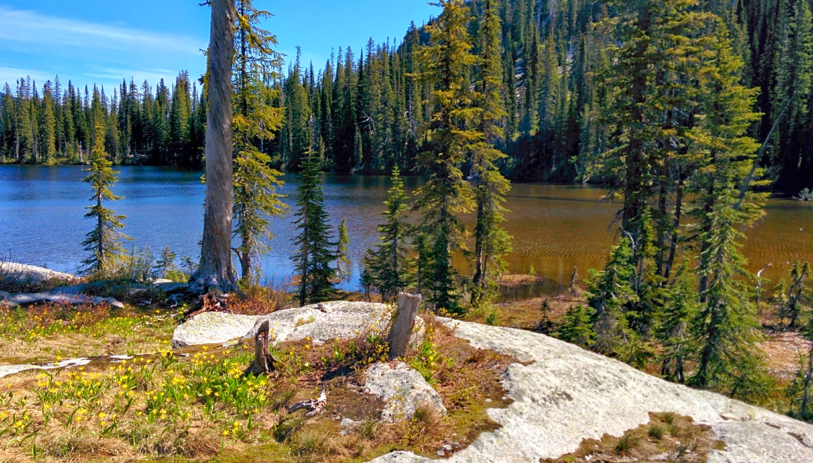
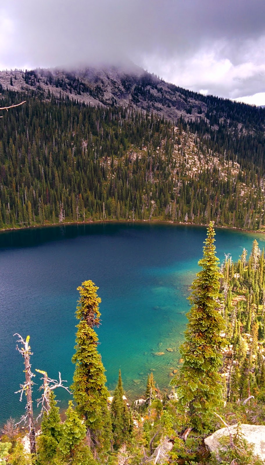
Little Harrison Lake seems to sit in a bowl of pure granite, giving it a deep-blue sapphire color unlike that of the other lakes within the Selkirks. I had gazed upon it during a trip to Beehive last summer and instantly knew that I would return to scramble down to the hidden gem. From the ridgeline, we could see that there was no one at the lake and so in high-spirits we dropped the roughly 500 feet down boulders and cliffs to the water below.
 |
| Little Harrison Lake |
 |
| Harrison Peak |
After finding a spot on the granite slabs along the Northern shore, we set up camp and built a fire. Although it was still overcast and some clouds were low on the surrounding peaks, we left our rainflys off, hoping that it might clear up and we'd get to view some stars. It cleared up just as we went to sleep and we did see stars, however just like at Snowshoe Lake, we were woken up by the pitter-patter of rain around midnight and we both scrambled to get our gear covered.
 |
| Little Harrison Lake |
 |
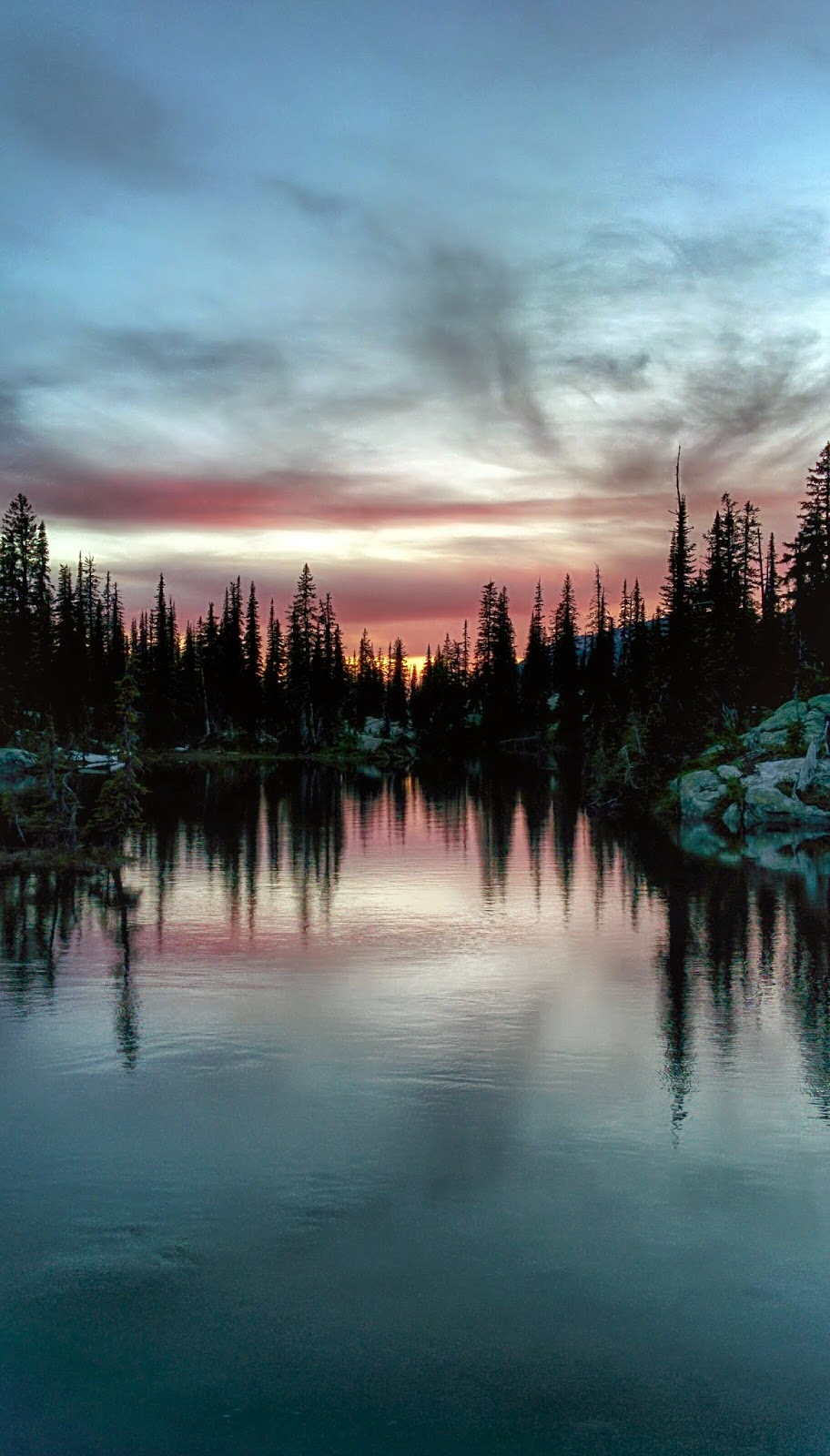
| Sunset |
 |
| Sunrise on Little Harrison Lake |
 |
Sunrise on
Little Harrison Lake |
Sunday morning, we awoke to a sunrise with whispy clouds. Although the warmth of the sun felt good, it was cold out and the light was spotty as the sky once again clouded up. Our plan for the morning to was to traverse the high-elevation basins between us and Harrison Lake, summit Harrison Peak, hike down the Harrison Lake trail, and then road-walk back to Beehive Lake trailhead. After packing up, we climbed out of camp and began following the bottom of the ridge North. The hiking was fairly-easy for an off-trail trek, as we crossed subalpine meadows scattered among large fields of boulders, all while the high cliffs and granite slabs of the ridge towered above us. Throughout the journey, the rain and strong winds came and went as the weather fought to make up it's mind.
 |
Meadow above
Little Harrison Lake |
We covered the 2 mile traverse in roughly 3 hours and found ourselves standing on the ridge above Harrison Lake. Very high cliffs stood between us and the trail below and as we attempted to route-find our way down, we kept hitting sheer-drops. Up until this point, the trek had been not much more than a moderate scramble, but now were unsure as to how we would get down. After finding a cliff with a set of ledges that we hoped we would be able to down-climb, things got a little scary. I went first by scooting down my butt on a steep slab of mossy-granite with little to hang on to. Bracing with basically only my feet, I got to the bottom of the slab which then dropped into an even-steeper grass slope, with more cliffs below it. Unsure of what the route in the cliffs below the slope was like, I lowered myself down in the grass and clawed my hands into the dirt. After a slippery and exposed descent of the grass slope, I found myself standing on a narrow ledge of rock above another 30 feet of vertical cliff with no further way down. Justin too slid down the granite slab and watched from the ledge above the grass slope as panic set in and we considered our options. Not knowing if it was even possible to climb back up the slab we had butt-scooted down, Justin gave it try. After a few minutes he yelled down that he had made it and after calming myself down, I pulled my way back up the grass. Heart racing, I reached the top of the grass, however I was unable to find a hand-hold and pull myself back up and over the lip of the first slab. Justin once again worked his way back down to the ledge, braced his feet and was able to pull me up and over. As we slowly inched-backwards up the slab, it began to rain again, making the situation even more dangerous. Fortunately, we made it back to the top of the rock and took a few minutes to sweat-out the adrenaline and reconsider our route. We headed back uphill and cut south, finding a much more mellow path down the cliffs.
 |
| Little Harrison Lake |
 |
Harrison Lake with
Harrison Peak
in Clouds above |
When we finally reached the Harrison Lake trail, Harrison Peak was hidden in the clouds. The rain was still coming in regular intervals and after the cliff incident, we decided we had had enough and it was time to go. So we set out down the trail and hiked the couple miles down the road to the car.
I have visited many of the backcountry lakes in the Selkirk Mountains within the Bonners Ferry and Sandpoint Ranger districts and Little Harrison is one of, if not the prettiest. This place is incredibly beautiful and the remote/hard-to-reach location ensures a good chance of finding solitude.